
When I inspected and measured my first roof back in the late 1980’s the world was a very different place. The word “drone” referred to a male bee and photo options were limited to Kodak Film or Polaroids.
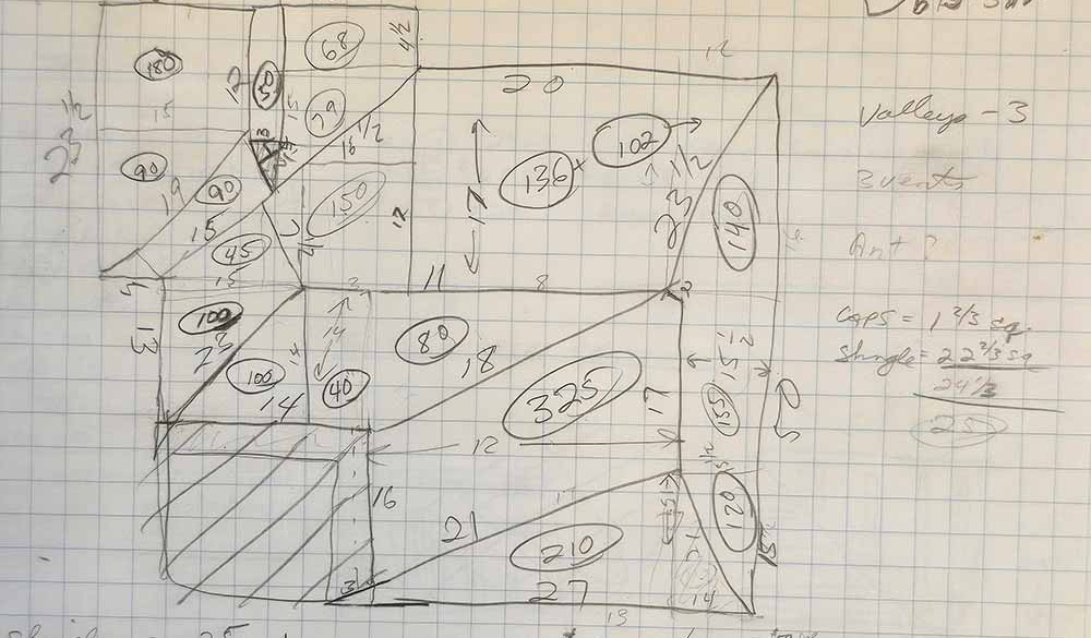
Graph paper was the preferred medium to layout measurements of any construction project. Now, technology has completely transformed how roofing contractors measure and estimate jobs—bringing huge benefits in terms of accuracy, safety, and efficiency.
Measuring Roofs in 1989 – The Old School Way
In 1989, my estimating toolkit consisted of graph paper, a pencil, a sturdy tape measure, and a good pair of work boots. To measure a roof, I would set up my ladder, get out my 25-foot tape measure and start scribbling away notes about lengths and widths and even put some of my trigonometry lessons to use!
The First Big Shift – Satellite Imaging and Aerial Measurements
Satellite imaging started to become available in the 2000’s. Services like EagleView and Roofr started offering aerial roof measurements using high-resolution satellite images. Suddenly, we could get basic measurements without ever leaving the ground.
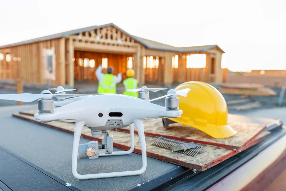
The Drone Revolution – A Game Changer for Roofers
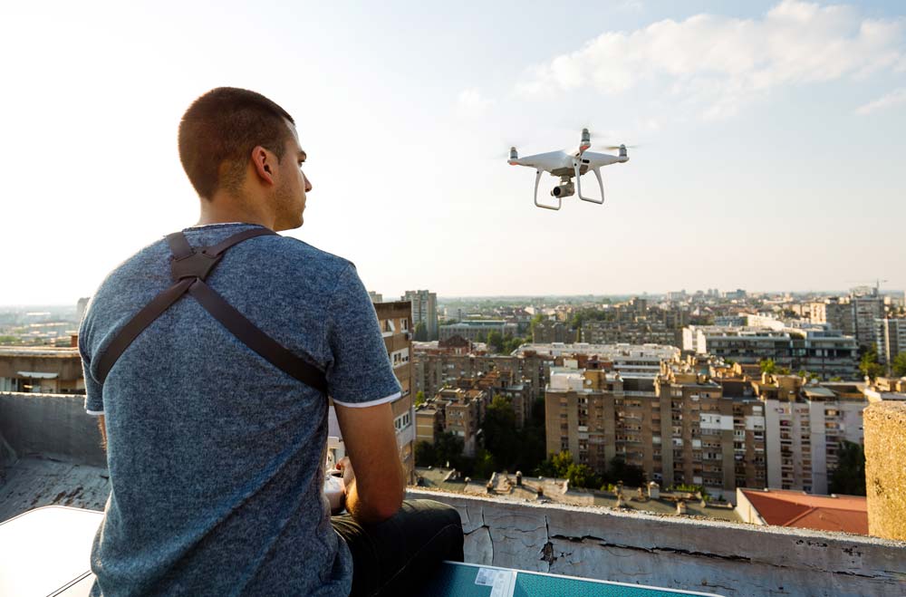
As drone technology advances and the price dropped, I discovered that I could add one more element to the estimating toolbox- allowing me to get to spots that were very difficult to reach before. So, I studied for my FAA remote pilot exam, got my official license and got myself a state-of-the-art mini drone. It’s made an incredible difference in how I work. With a drone, I can capture crystal-clear images and videos of every square foot of a roof—including hard-to-reach areas like steep slopes, chimneys, and valleys.
Drones offer several benefits for roof measuring:
- Increased safety: I spend far less time climbing ladders, reducing the risk of falls.
- Greater accuracy: Drones capture high-resolution images that allow for precise measurements using advanced software.
- Faster estimates: I can gather all the data I need in a matter of minutes instead of hours.
Advanced Imaging Software and Mobile Apps – The Power in Your Pocket
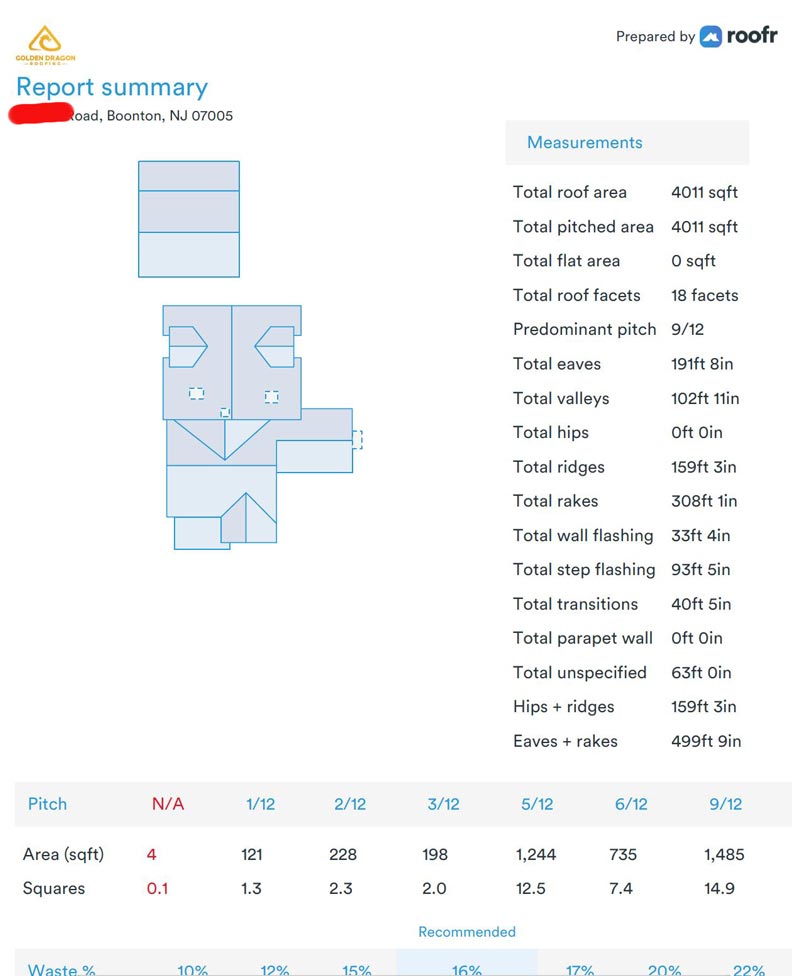
Today, my smartphone is as much a part of my estimating toolkit as my measuring tape used to be. I can snap photos from the ground or the roof itself, upload them to advanced imaging software, and generate accurate measurements in minutes. I use an app that integrates directly with my estimating software, so I can create professional proposals right on the spot.
Using modern imaging software, combined with my drone images and videos, and my smartphone, I can get a roof report that is complete with measurements, slopes, and material estimates. Everything is stored in the cloud, making it easy to access job files from anywhere, whether I’m in the office or on-site with a customer.
The Benefits to Homeowners and Property Managers
All these technological advancements aren’t just good for contractors like me. They benefit homeowners and property managers, too. Here’s how:
- Faster Estimates: Jobs move faster when I can provide accurate quotes the same day.
- Greater Accuracy: Accurate measurements mean fewer surprises and change orders down the road.
- Better Documentation: High-resolution images and reports provide clear documentation for insurance claims and future maintenance.
- Improved Safety: Safer estimating practices mean lower liability and insurance costs for contractors, helping us keep prices competitive.
To DIY or not-to DIY
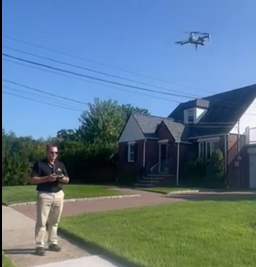
You may be saying to yourself, well, why can’t I just fly my own drone and rent the same software to inspect my roof. You certainly can. However, you should be aware of several things before you go online and purchase a cheap drone and start flying.
DIY Watch-out’s for drone flights and inspections:
- All drones are not created equal. A commercial-grade drone that has hi-rez imaging and anti-collision software can cost anywhere from $1200 to $5,000 and more. Professionals use these high-end drone to ensure image quality and high levels of safety. Running a drone into electrical wires, a window or a concrete driveway is a quick way to end your drone-flying experience in a very bad way. The best commercial drone will avoid other objects, land automatically before the battery runs out, and take amazing pictures and videos at the touch of a button
- Commercial drone flights are regulated by the FAA. To legally operate a drone for commercial use (which includes a roofing company measuring a roof) the operator must be licensed with the Federal Aviation Administration, the same government agency that regulates all the airline flights and pilots in the US. The FAA’s Certified Drone Pilot Certification requires hours of study to pass an exam to obtain an official certification card. The exam cover an extensive range of topics, including weather patterns, safety rules involving people and property and various rules regarding who can fly, when, are where. There are many rules that relate to flying within a certain range of any airport and how that affect the altitude and special permissions.
- Roofing software: there are several software programs that can help inspect roofs and analyze damage. Unfortunately, most of these come with a hefty price tag or a contract.
Looking back on the way we measured roofs in 1989, it’s incredible to see how far technology has come. Today, thanks to satellite images, drones, and advanced software, I can provide faster, safer, and more accurate estimates than ever before. For homeowners and property managers, that means better service, clearer communication, and more peace of mind.
If you’re in need of a roof inspection or estimate, reach out today — and experience the benefits of modern roof measuring technology for yourself.